


Neosho Township Voting District, Coffey County, Kansas
About
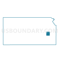
Outline

Summary
| Unique Area Identifier | 584294 |
| Name | Neosho Township Voting District |
| County | Coffey County |
| State | Kansas |
| Area (square miles) | 48.14 |
| Land Area (square miles) | 47.76 |
| Water Area (square miles) | 0.38 |
| % of Land Area | 99.22 |
| % of Water Area | 0.78 |
| Latitude of the Internal Point | 38.07478410 |
| Longtitude of the Internal Point | -95.72963270 |
Maps


Graphs
Select a template below for downloading or customizing gragh for Neosho Township Voting District, Coffey County, Kansas


Neighbors
Neighoring Voting District (by Name) Neighboring Voting District on the Map
- Burlington Township Voting District, Coffey County, KS
- Hampden Township Voting District, Coffey County, KS
- Leroy Township Voting District, Coffey County, KS
- Liberty Township Voting District, Coffey County, KS
- Liberty Township Voting District, Woodson County, KS
Top 10 Neighboring County Subdivision (by Population) Neighboring County Subdivision on the Map
- LeRoy township, Coffey County, KS (669)
- Liberty township, Coffey County, KS (555)
- Burlington township, Coffey County, KS (341)
- Liberty township, Woodson County, KS (176)
- Neosho township, Coffey County, KS (131)
- Hampden township, Coffey County, KS (128)
Top 10 Neighboring Unified School District (by Population) Neighboring Unified School District on the Map
- Burlington Unified School District 244, KS (4,151)
- Woodson Unified School District 366, KS (2,747)
- Leroy-Gridley Unified School District 245, KS (1,666)
Top 10 Neighboring State Legislative District Lower Chamber (by Population) Neighboring State Legislative District Lower Chamber on the Map
- State House District 9, KS (21,122)
- State House District 76, KS (20,876)
- State House District 13, KS (17,996)
Top 10 Neighboring State Legislative District Upper Chamber (by Population) Neighboring State Legislative District Upper Chamber on the Map
Top 10 Neighboring 111th Congressional District (by Population) Neighboring 111th Congressional District on the Map
Top 10 Neighboring Census Tract (by Population) Neighboring Census Tract on the Map
- Census Tract 9662, Coffey County, KS (2,947)
- Census Tract 9661, Coffey County, KS (2,703)
- Census Tract 966, Woodson County, KS (1,720)